Food Archipelagos of the Sacramento River Delta (SRD)
In the next 100 years, the ocean will rise approximately 1 meter, completely inundating the nation’s most fertile region with sea water.
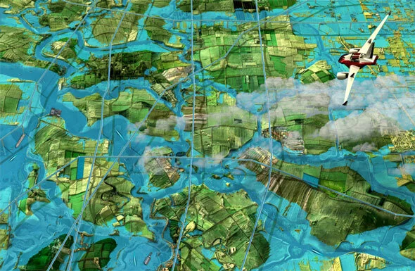

From left to right: SF Bay Area and SRD 2010, Projected SRD Flooding by 2110, Food Archipelagos
Dredging and the management of dredged material are an important function in the United States and the Bay area. In order to maintain channels and harbors at safe depths, periodic dredging is required. Annually, the U.S. dredges about 400 million cubic yards of material from its waterways. Of this amount, about 60 million cubic yards are placed in ocean waters and the other 340 million cubic yards are dredged in coastal and inland waters and placed in a variety of locations, including uplands, beach sites, wetlands construction sites and riverine sandbars.

In 5 years dredged material from the San Francisco Bay alone would tower exceed the height of the Trans America pyramid.

Mega Terroir Food Archipelagos and Fresh Water Aqueducts 2110
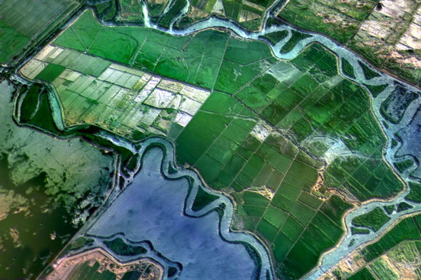
The delta consists of a myriad of small natural and man-made channels that create a system of 70 isolated lowland islands (20 feet below sea level) protected by levees. It is one of the most fertile agricultural areas in the nation, but it’s agricultural future is in danger.
By relocating dredged material to the existing islands, which is the original home of the material in the delta (and 99% similar to the existing farm soil), a new agricultural topography is created–a mega terroir–and the precious farmland continues to be productive after the inevitable seal-level rise.
Bacon Island in the Sacramento River Delta 2010

Bacon Island in the Sacramento River Delta 2050

Bacon Island in the Sacramento River Delta 2110
From the new elevated farmland a new terrior will blossom, one that also takes advantage of the ocean water. For example, farmers may elect to grow oysters and mussels in low intertidal zones, plants that are salt tolerant and may be irrigated with brackish water such as melons, may be planted sea side.

By 2110, changing agricultural practices forced by rising tides will reshape the SRD landscape.
Traditional crops and orchards will receive fresh water from a series of newly constructed aqueducts and will be planted at the upper elevation of the newly mounded archipelagos. The agri-hills will be shaped to create tidal pools and at optimal soil and solar angles for growing food, forests, accommodating wildlife and tourism.

From left to right: Pre 1850, current and projected section through Sacramento River in the delta region

Section through the agricultural biomes of the food archipelagos
Project Date: 2009
Project Team: Ronald Rael, Virginia San Fratello, Emily Licht